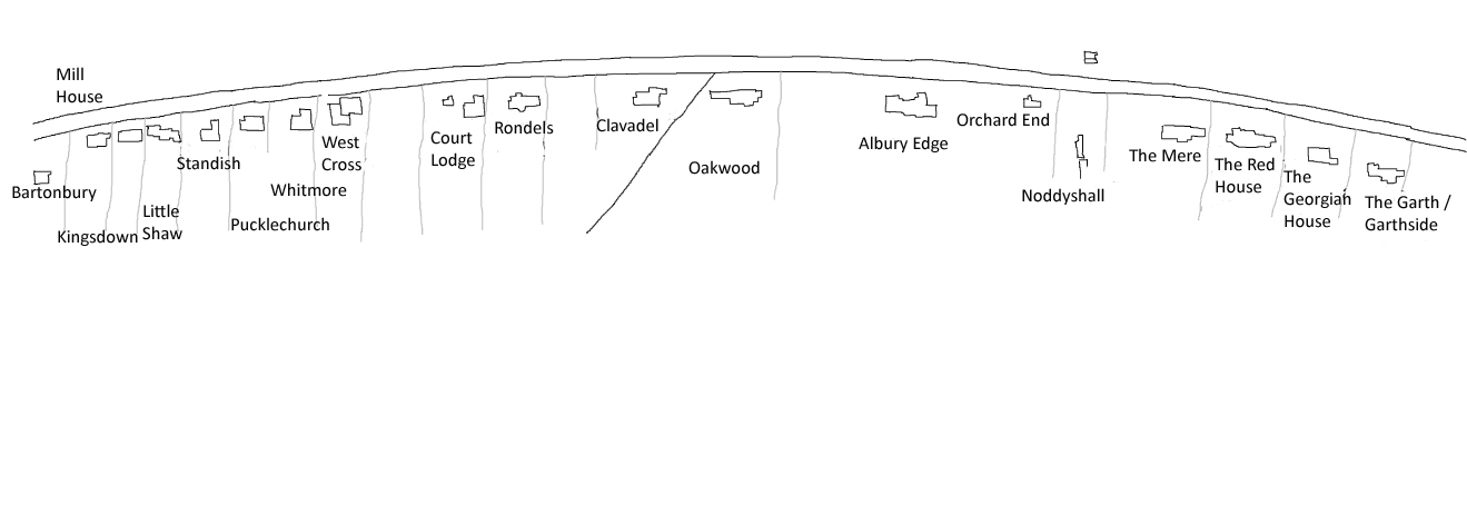
This sketch map is based on a map drawn in 1912 (north is up). It shows the houses as they were at that date (but with their present name, if that is different).
Note that there are several undeveloped sites; note, too, the two cottages to the north of Noddyshall. These were the only buildings on the north side of the road at this date.
By clicking on the outline of a house (the house names are as they were in 1912) you can see more information about it. Use the navigation bar at the foot of the screen to return to this map.
The diagonal line between Clavadel and Oakwood, approximately in the centre of the map, is an ancient footpath, still in existence.
Click here for a map of 1964 showing all the houses present at that time.